Guide
Route 1 in Maine: Coastal and Northern Stops

Route 1 in Maine is not a scenic byway in the designed sense. It is the state's original main street, and it still behaves like one: strip malls in Ellsworth, a lobster-roll queue that stops traffic in Wiscasset, farm stands in Waldoboro, and stretches where the ocean is a mile away behind a wall of spruce. Driven badly it is a slow, frustrating alternative to the interstate. Driven with a plan, it is the best way to understand how the Maine coast is actually put together.
Related planning guides: Things to Do in Eastport, Maine: Bay, Streets and Arts; Things to Do in Belfast, Maine: Harbor Walk and Town.
What Route 1 is, and which part you actually want
US Route 1 enters Maine on the bridge from Portsmouth, New Hampshire, and does not leave until Fort Kent on the Canadian border, more than 500 miles later. That makes Maine the state with the longest stretch of Route 1 anywhere on the road, and it means "driving Route 1" can mean wildly different things.
For almost every visitor, the road divides into three pieces. Kittery to Ellsworth (roughly 200 miles) is the coastal tourist route, and it is the part people mean. Ellsworth to Calais is another 95 miles of Downeast coast with a fraction of the traffic and a fraction of the services. North of Calais the road turns inland and runs up through Aroostook County potato country to Fort Kent, which is a genuinely different trip.
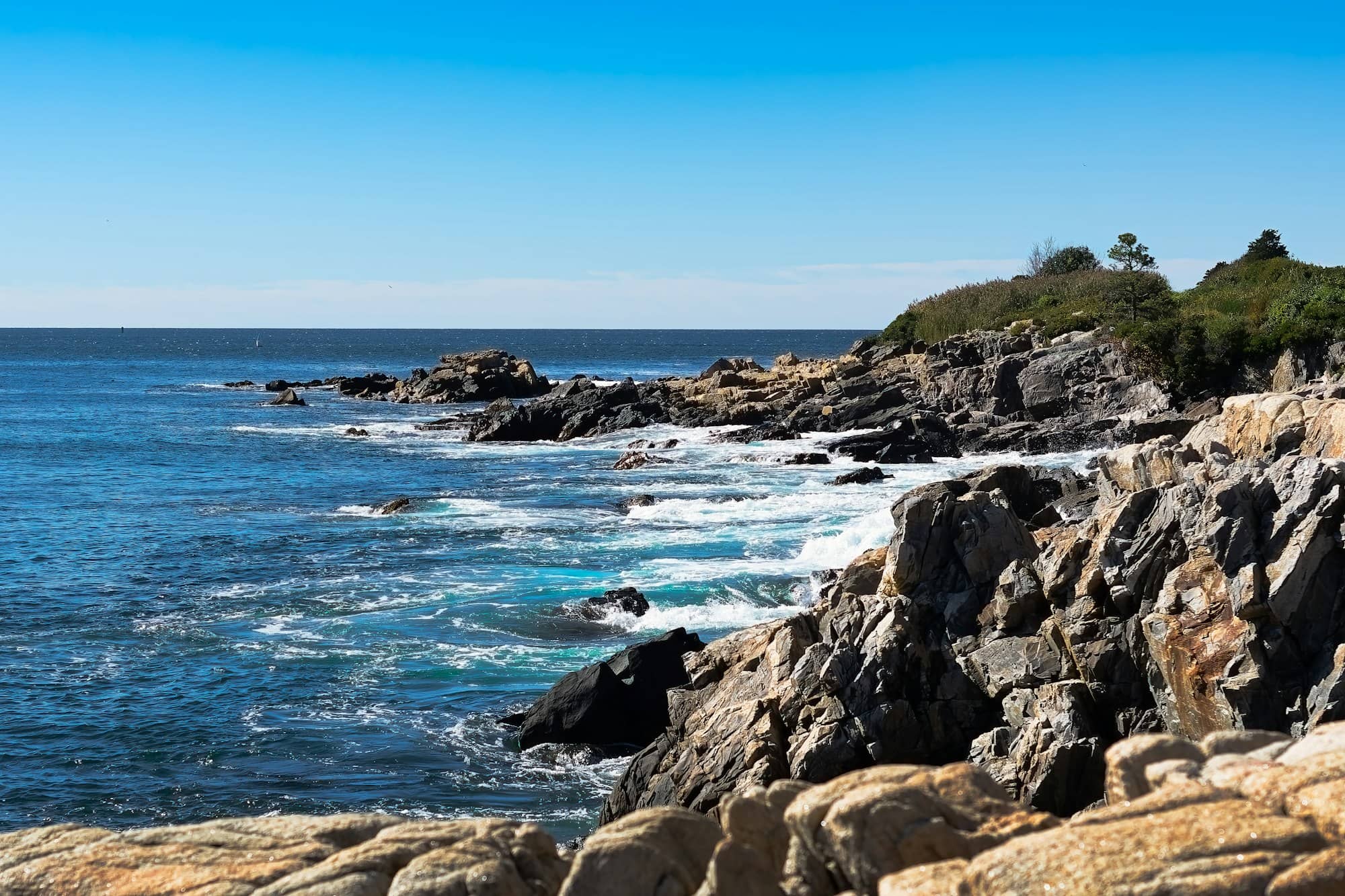
The other thing to know before you commit: Route 1 is not a coastal road in the way people picture. Between towns it runs through woods, and the water appears only where the road crosses a river or drops into a harbor. The views are at the ends of the side roads, not on Route 1 itself. Budget time for detours or you will drive 200 miles and see very little ocean.
Segments at a glance
| Segment | Approx. miles | What it is for | Traffic |
|---|---|---|---|
| Kittery to Kennebunk | 30 | Beaches, outlets, lighthouses, the closest coast to Boston | Heavy every summer weekend |
| Kennebunk to Portland | 25 | Mostly a connector; Old Orchard and Cape Elizabeth are the detours | Moderate to heavy |
| Portland to Bath | 35 | Freeport outlets, Brunswick, the Kennebec crossing | Heavy in Freeport and at Bath shift change |
| Bath to Rockland | 50 | Peninsula country; the classic midcoast | The Wiscasset bottleneck |
| Rockland to Belfast | 30 | Harbors, hills, windjammers, art museums | Slow through Camden village |
| Belfast to Ellsworth | 40 | Penobscot Bay, Fort Knox, the gateway to Acadia | Backs up in Ellsworth |
| Ellsworth to Calais | 95 | Blueberry barrens, working harbors, big tides | Almost none |
Kittery to the Yorks: mile zero
Kittery is where Route 1 begins in Maine, and its first miles are outlet stores. Past them, the road recovers quickly. Fort McClary in Kittery Point (4.7 from more than 1,300 reviews) is a hexagonal blockhouse on the Piscataqua with a picnic lawn, and Fort Foster a little further out (4.7, nearly 700 reviews) is the better spot if you want to swim.
York is the first real detour. Route 1 bypasses the beaches entirely; you leave it at Route 1A to reach Long Sands Beach (4.7, more than 1,200 reviews) and Sohier Park (4.8, more than 1,300 reviews), the parking lot that looks across at Cape Neddick Light, better known as the Nubble, which holds 4.9 from more than 600 reviews. That short loop rejoins Route 1 north of town and takes about 30 minutes without stops.
Ogunquit, Wells, and the Kennebunks
Ogunquit is where the traffic starts to bite. The village sits right on Route 1, the beach parking fills by mid-morning in summer, and the two-lane road through town moves at walking pace on August afternoons. It is worth it: the Marginal Way cliff path, the Ogunquit Playhouse (4.8 from nearly 1,500 reviews), and Footbridge Beach (4.8, more than 700 reviews) at the quieter north end.
Wells is the Route 1 town in its purest form: three miles of motels, mini golf, antique barns, and a run of seafood institutions that people plan the drive around. Mike's Clam Shack holds 4.4 from more than 3,000 reviews and Billy's Chowder House 4.4 from nearly 3,000, both on that strip. Congdon's Doughnuts, at 4.8 from more than 4,000 reviews, has the highest rating of any of them and a drive-through line to match.
North of Wells, Route 1 runs past the Rachel Carson National Wildlife Refuge headquarters in Kennebunk (4.7 from more than 2,000 reviews), where a mile-long boardwalk loop through salt marsh takes about half an hour and is one of the few genuinely quiet stops on this section. Kennebunkport itself is a few minutes off the road; the Seashore Trolley Museum in Arundel (4.7, more than 1,000 reviews) is right beside it.
Through Portland, and the detour that is worth it
Route 1 from Saco to Portland is the least rewarding stretch of the whole coastal run. Car dealerships, plazas, and lights. If you are in a hurry, this is the section to hand over to I-95 or I-295 without guilt.
If you are not in a hurry, leave Route 1 in Scarborough and take the shore road through Cape Elizabeth instead. That is where Portland Head Light sits inside Fort Williams Park, and the numbers explain why: the light holds 4.8 from more than 16,700 reviews, the highest-volume lighthouse in the corpus by a wide margin, and the park itself carries 4.8 from more than 3,700. It adds maybe 40 minutes to the drive and it is the single best-known view in Maine.
Freeport to Bath
Freeport is a planned stop or no stop at all. The outlet village straddles Route 1 and pedestrian traffic slows everything to a crawl in season. Two things nearby earn a detour on their own: Wolfe's Neck Woods State Park (4.8, more than 1,400 reviews), a shoreline forest walk five minutes from downtown, and the Desert of Maine (4.5, more than 1,100 reviews), a genuine sand barren left by bad farming and a glacier.
Brunswick brings the road onto a proper main street with Bowdoin College at one end. Then Route 1 crosses the Kennebec into Bath, a shipbuilding city where Bath Iron Works still launches destroyers. Time this crossing carefully. The yard's shift change dumps thousands of cars onto Route 1 and the bridge, and it will cost you 20 minutes if you hit it. The Maine Maritime Museum on the river south of town (4.7 from nearly 1,500 reviews) is the best indoor stop between Portland and Rockland.
Wiscasset: the famous bottleneck
Wiscasset calls itself the prettiest village in Maine and is better known for its traffic. Route 1 drops down a hill, crosses the Sheepscot River on a two-lane bridge, and passes a lobster roll stand: Red's Eats, 4.3 from more than 3,300 reviews, whose line regularly spills onto the sidewalk and stops the through traffic dead. Sprague's Lobster (4.5, more than 1,100 reviews) sits a hundred yards away on the water with picnic tables and, usually, a shorter wait.
The honest advice: in July and August, either commit to stopping in Wiscasset or route around it inland. Sitting in the queue for 25 minutes to drive past a lobster stand you are not visiting is the classic Route 1 mistake. Our Wiscasset guide covers what is in the village beyond the bridge.
Damariscotta to Rockland
This is where the peninsulas start, and where Route 1 becomes a spine you hang detours off. From Wiscasset, the Boothbay peninsula runs south to Coastal Maine Botanical Gardens (4.8 from more than 7,000 reviews) and Boothbay Harbor. From Damariscotta, the Pemaquid peninsula runs down to Pemaquid Point Lighthouse (4.8, more than 3,200 reviews) on its tilted slabs of rock. From Thomaston, the St. George peninsula ends at Marshall Point Lighthouse (4.8, nearly 1,500 reviews) and its short white walkway.
Each of those detours is 40 to 60 minutes each way from Route 1. You cannot do all three in a day and should not try. Pick one and drive it to the end. The pattern repeats the whole length of the midcoast: the road you are on was built to connect towns, and the towns were built at the heads of the bays, not on the points.
Route 1 itself runs through Waldoboro and Warren, past farm stands and a state prison showroom, and into Rockland. Rockland is a working harbor with the Farnsworth Art Museum downtown, the mile-long granite breakwater out to Rockland Breakwater Lighthouse (4.8, more than 1,300 reviews), and the Owls Head Transportation Museum just south (4.8, 1,000 reviews).
Camden to Belfast
Camden is the eight-mile stretch where Route 1 is genuinely beautiful and genuinely slow. The road runs along the harbor between shops, with the Camden Hills rising immediately behind. Camden Hills State Park (4.7, more than 2,000 reviews) has an auto road up to Mt. Battie Tower (4.8, more than 800 reviews) and a view over the whole of Penobscot Bay. The best return on effort anywhere on Route 1. In Rockport just south, the harbor has a statue of Andre the Seal (4.7, more than 550 reviews), a local celebrity animal from the last century.
The village itself is a bottleneck of a different kind from Wiscasset's, not one stalled queue but a slow grind of pedestrians crossing between the harbor park and the shops. Park once, on a side street uphill, and walk. Camden also has the highest concentration of schooner berths in the state; the windjammer fleet ties up within sight of the road.
North of Camden the road finally meets the water properly. Lincolnville Beach (4.6, more than 600 reviews) is right at the roadside, with the Islesboro ferry leaving from the same spot. Belfast has a compact brick downtown worth an hour, and past Searsport (once a captains' town, now an antiques town) Moose Point State Park (4.7, more than 550 reviews) puts a picnic area on the bay.
The Penobscot crossing and Ellsworth
The best five minutes on Route 1 come at Bucksport. The road crosses the Penobscot on the Penobscot Narrows Bridge (4.8 from more than 400 reviews), a cable-stayed span with two granite-clad towers, and one of those towers contains an elevator to a glassed-in observatory near the top. It shares a site with Fort Knox, a mid-19th-century granite fort you can walk through with a flashlight; together they hold 4.8 from more than 3,200 reviews. It is the one stop on this road that surprises people who thought they knew what to expect. Sandy Point Beach in Stockton Springs (4.6, more than 550 reviews) is a short detour on the approach.
Ellsworth, half an hour on, is the funnel. Everyone driving to Acadia passes through it, Route 1 and Route 3 share the same commercial strip, and it backs up daily in summer. It is also where you restock. This is the last full-scale grocery run before either Mount Desert Island or the Downeast coast. Helen's Restaurant of Ellsworth (4.3 from more than 2,300 reviews) is the long-running pie stop.
Downeast: Ellsworth to Calais
Past Ellsworth, Route 1 empties out. The road runs through blueberry barrens that turn red in fall, crosses tidal rivers at Sullivan and Cherryfield, and passes through Milbridge, Harrington, Columbia Falls, and Machias, towns where the working waterfront is not a theme.
The detours here are long and worth it. Route 189 from Whiting runs out to Lubec, where West Quoddy Head Lighthouse (4.9 from nearly 1,500 reviews) and Quoddy Head State Park (4.9, more than 1,300 reviews) mark the easternmost point in the United States. Roque Bluffs State Park (4.7, more than 600 reviews) has a beach on one side of a bar and a freshwater pond on the other. Cobscook Bay State Park in Dennysville (4.6, more than 200 reviews) sits on water that rises and falls more than 20 feet with the tide.
Machias is the functional center of this stretch, with a college campus, a supermarket, and the last cluster of restaurants before the border. Beyond it the road runs through Whiting and Pembroke to Perry, where a roadside marker claims the halfway point between the equator and the North Pole, and then along the St. Croix River into Calais and its international bridge.
Two cautions. Services thin out dramatically. Plan fuel and food, and do not assume a restaurant will be open on a weekday in shoulder season. And the fog here is real: this coast can sit socked in for days while Camden is sunny.
How to actually drive it
Kittery to Ellsworth is about four and a half hours of pure driving with no stops and no traffic, and neither of those conditions will apply. Realistically, allow three days to do the coastal stretch properly, or a week if you want to drive the peninsulas.
Three habits make the difference. Drive Route 1 in the morning and use I-295 or I-95 to backtrack in the afternoon, when the coastal road clogs. Never plan a hard arrival time on a summer Friday or Sunday. And treat the road as a spine, not a destination. The payoff is always at the end of a side road. If you want a structured version, our Maine road trip itinerary lays out day-by-day stops.
Frequently asked questions
How long does it take to drive Route 1 in Maine?
The coastal stretch from Kittery to Ellsworth is roughly 200 miles and about four and a half hours of driving with clear roads. Summer traffic through Ogunquit, Wiscasset, and Ellsworth can add an hour or more. Driving the full Maine length of Route 1 to Fort Kent is more than 500 miles and takes two long days on its own.
Is Route 1 or I-95 better for driving up the Maine coast?
Use both. I-95 and I-295 are far faster for covering ground between clusters, especially Kittery to Portland and Brunswick to Waldoboro. Route 1 is worth driving where the towns are close together and interesting: Kittery to Kennebunk, Bath to Rockland, and Camden to Bucksport. Alternating between them is what locals do.
What is the prettiest section of Route 1 in Maine?
The Camden to Lincolnville stretch, where the road runs between the Camden Hills and Penobscot Bay, and the Penobscot Narrows crossing at Bucksport. Both put water and elevation in the same frame, which most of Route 1 does not. The Downeast section past Milbridge is emptier and starker, and appeals to a different taste.
Does Route 1 in Maine actually follow the ocean?
Rarely. The road stays inland of the peninsulas for most of its length and only touches salt water at river crossings and in a handful of towns like Lincolnville, Camden, and Belfast. To see the coast you drive the side roads south off Route 1. Cape Elizabeth, Boothbay, Pemaquid, St. George, and Schoodic all require leaving the highway.